Description
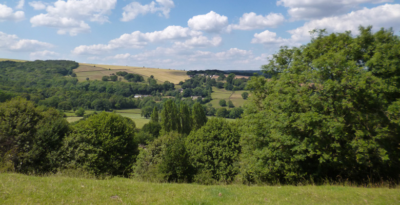
A circular walk from Oughtibridge along the banks of the River Don to Beeley Woods. The route then climbs through fields and park, with a short road section, to the village of Worrall. The route cross fields above Worrall before returning to Oughtibridge through Sensicall Park. A combination of riverside and open fields with views across to Wharncliffe Crags.
Information
- Length 4.0 miles
- Time – 2 hours
- Grade – The section from Oughtibridge to Beeley Wood is level, wide and a good surface and is suitable for buggies and wheelchairs. The route includes steps and stiles. Mostly well defined paths. Includes a steady ascent to Worrall. There is a short road section on Stockarth Lane.
- Start – Coronation Park, Oughtibridge.
- Grid Reference – SK 308 934
- Parking – On street parking in Oughtibridge. The top road from Sheffield has plenty of spaces.
- Public transport –57 and SuperTram link to Sheffield and Stocksbridge.
- Refreshments – Shops in Oughtibridge and Worrall
- Public toilets – Coronation Park (when the park is open)
Bradfield Walkers are Welcome routes can be found as recommended routes on the OS Maps App for mobile phones , tablets and pc.
Map of the walk route
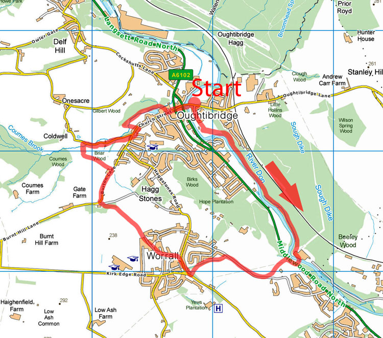
Oughtibridge to Worrall walk instructions
Cross the bridge over the River Don from Oughtibridge heading towards Grenoside.
At the end of the bridge take the footpath to the right and follow the path along past the sports club.
For level access to the riverside walk proceed past the footpath and go right down Waterside gardens and then right again down the lane.
Follow the path for almost a mile.
As the path approaches the factory buildings take the right fork leaving the main path which goes to the left of the buildings.
Follow the path along the bank of the Don to the wooden footbridge.
Cross the bridge and take the steps up to the pavement by Middlewood Road North. This is a busy road with fast moving traffic
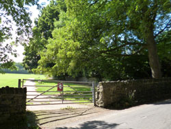
Go right for 50m. Cross the road and go up the stone steps. Continue up the path past the farm buildings and up the hill to Stockarth Lane.
Turn right and continue up the road for approximately half a mile and take the second footpath on the left. Just before the footpath there is an entrance to Worrall Recreation Ground. To go up through the park enter through the narrow gate at the bottom end of the footpath.
The footpath and path through the park opens out onto Worrall Road. Turn right and head into Worrall.
Cross the zebra crossing and continue past the Blue Ball Inn and then take the left fork up Towngate Road.
At the junction with Top Road continue along Towngate Road.
Continue to the end of Towngate Road which then peters out into a wide but overgrown track between the walls and open fields.
At the end of the track cross the stile and continue ahead through the fields keeping the wall to your right.
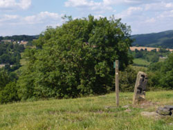
The path is not clear at this point. On arriving at a bank with a finger post and with extensive views over Oughtibridge and Onesacre turn left and follow the top of the bank.
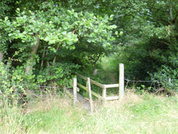
The path becomes clearer as it drops down to a wooden stile in the woods.
Cross the stile and follow the path down to the track and then out the tarmac road, Burton Lane.

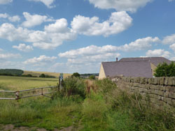
Continue to the farm house on the left. Immediately after the entrance to the farm cross the stone stile on the left.
Cross the farmyard dropping down to the rear of the buildings. The path is not marked at the time of writing.
Cross the stone stile at the the bottom of the grassed area.
Take the path across the field keeping wall to your right.
When the wall kinks right at the big tree go through the
gateway and continue in the same general direction, now with the wall to
your left.
Cross the stone stile. Go straight ahead across the field towards the trees. After 20m a narrow footbridge will come into view.
Cross the bridge and follow the path up onto Wheel Lane.
Turn right and follow the road down to Church Street.
Go down Church Street passing four properties on the left.
Take the track which cuts back to the left before number 76.
This is the entrance to Kaye Meadows and Sensicall Park but does not have a sign at the time of writing.
Go down the track passing the metal gate. At the bottom go right.
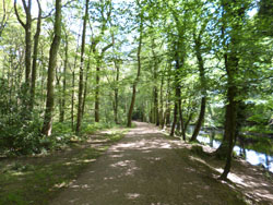
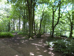
Follow the path down through the woods.
The path emerges from behind the doctor’s surgery. Turn left and go down down the road to Oughtibridge Village.
Cross the one way system; go down Bridge Hill, cross the second one way system back to starting point.
Historical Notes
Coronation Park – Was established in 1911 as a public pleasure ground thought to be given by the Dixon family and gifted to Bradfield Parish Council in 1924. It was renamed Coronation Park in 1953 to mark the Coronation of Queen Elizabeth II.
Don Bridge – Replaced a previous bridge, the remains can still be seen from the corner of Forge Lane and the current bridge.
Public House – Oughtibridge has had 9 public houses and a Working Men’s Club but now only 4 public houses survive.
Worrall Community Centre – has now been established as a Community Centre for the village – previously being built as an annex for the former Junior School and also to Bradfield Secondary School and also used for showing films in its early years.
Birtin Cemetery – opened in 1906 as an overflow for Oughtibridge Church of Ascension – it is now owned and maintained by Bradfield Parish Council – the Walls of Remembrance for interment of ashes was added during the 1960s.
Kaye Meadows/Sensicall Park – Both owned by Bradfield Parish Council, Kaye Meadows had a row of houses which were demolished in the late 1960s and is now used as garden allotments. Sensicall Park was named to honour local man Robert Sensicall who had a number of roles on the village, the pond on the right is the former mill pond for the Corn Mill and now used as a fishing pond.
Mobile Phone Coverage – Mobile phone signal coverage is mostly good in this area. Intermittent signals can be received on higher ground.
Ordnance Survey map OL1 Dark Peak is recommended for all the routes on this web site.
Great care has been taken to ensure that the information on this web site and associated documents is accurate. However, we accept no liability for any claim, loss, damage or injury (howsoever arising) incurred by those using the information provided. Except where expressly stated to the contrary, copyright in the text, graphics and information contained in this web site (including downloads) is owned by Bradfield and Stocksbridge Walkers. You may print, or download to a personal computer, extracts for personal use. Permanent copying and/or storage of whole or part of this web site or the information contained therein or reproduction or incorporation of any part of it in any other work or publication whether paper or electronic media or any other form is expressly prohibited unless agreed otherwise.
Copyright – Bradfield and Stocksbridge Walkers 2024