Description
A walk around Langsett Reservoir in the Dark Peak which combines woodland with views across open moorland. Much of the walk is on Yorkshire Water land and consequently is very well signed and maintained. There is a steady climb from the top of the reservoir to the turn on the moor, but the views are well worth the walk. The path leads on to North America for those who want an intercontinental feel to their walk!
This walk is sponsored by Bank View Cafe, Langsett
Information
- Length 3.5 or 5.3 miles
- Time – 2.5 hours for the shorter walk.
- Grade – Steady ascent and descent across fields. A short section on roads. The paths are well defined. There are stiles, steps and gates.
- Start – Langsett Barn Car Park. (Toilet facilities available.)
- Public transport – none.
- Refreshments – The Waggon and Horses Inn, Bank View Café, Langsett
- Public Toilets – Langsett Barn.
- Grid Reference – SE 21050 00458
There is an option to extend the walk by going further up Cut Gate path and then cutting back to North America.
Download the Langsett walk information.
Bradfield Walkers are Welcome routes can be found as recommended routes on the OS Maps App for mobile phones , tablets and pc.
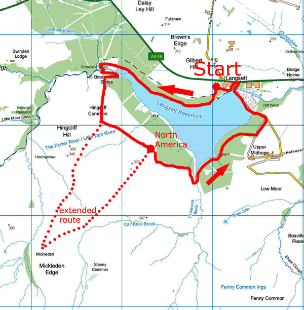
Map of the Langsett walk route
Route Instructions
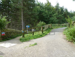
Parking is free at the Langsett Barn (See Points of Interest 1) car park. It does get busy, so if it is full use the lay-by 200 m further up the hill from the main car park.
There are three routes from the Langsett Barn car park to the Brookhouse Bridge at the top end of the reservoir (2). They all lead to the same location.
The paths exit from the corner of the car park opposite the barn.
The top path has been constructed as a bridle way, and is wide and has a chippings surface. This can be the best path following wet weather.
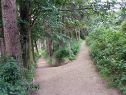
The second path runs along the top of the woods on the other side of the wall to the bridle path.
The third path heads down into the woods and works its way down to follow the side of the reservoir. The views are best from this path but it can get muddy in wet weather.
At the top end of the reservoir turn left and head down the steep lane to Brookhouse Bridge over the Little River Don, also known as the Porter.
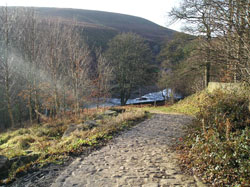
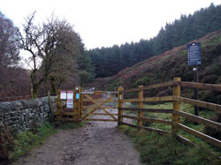
Cross the bridge to the gates. In summer this is a popular spot for children to paddle in the shallow water.
Take the single gate on the left of the bridge and enter onto the Access Land.
The path swings back on itself as it climbs up to the moorland. Follow the well defined wide path up onto the moor.
After 1/4 mile from opening out on the moorland there is a marker post and a broken down stone wall. The Cut Gate (3) path continues up to Mickledean Edge and the Derwent Valley beyond. Take the wide path off to the left.
For the longer walk continue on the Cut Gate Path. After one mile take the signposted footpath left back across the moor, rejoining the main route at the ruins of North America.
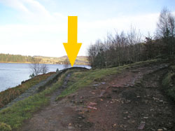
There are great views of Langsett Reservoir and beyond from this point.
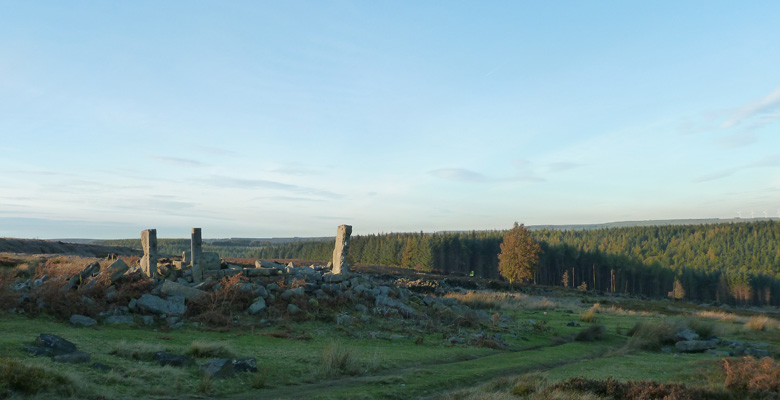
Follow the path across the moor. The path will take you to the ruins of the North America farm buildings (4). These buildings were used for target practice in the second world war.
Go through the gate and travel down Thickwoods Lane (5) and cross the stream on the little bridge. Continue along the lane and through the metal gate. The lane swings up to the right. Follow the path that goes straight on by the side of the reservoir.
Follow the path through the woods. After a few hundred metres the path swings up to the right and climbs to Joseph Lane. Pass through the gate onto the lane.
Turn left and go down the lane to the main road, Midhope Cliff Lane. Turn left onto the road and follow the road over the dam and back towards the Langsett village (6).
When you reach the A616, called Whams Road at this point turn left and pass The Waggon and Horses Inn, Turn left past the Inn and follow the lane past the houses and finally up a passage to the rear of Langsett Barn.
Now you have finished the walk why not stroll back to The Waggon and Horses Inn , or if you prefer, the Bank View Cafe across the road is also very popular.
Points of Interest
1. Langsett Barn.
The barn is now used as a Park Park ranger centre and is available for community use. It is of timber frame construction, with a stone dated 1621 on the gable end of the barn. The big double doors on the far side would have allowed fully loaded horse-drawn carts to enter and unload.
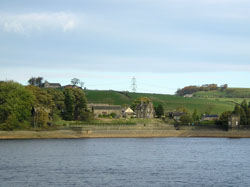
2. Langsett reservoir.
The reservoir was constructed between 1889 and 1905, and is now managed by Yorkshire Water. It is around a mile long, with an area of 51 hectares, and supplies water for Sheffield and Barnsley. A temporary village of corrugated iron huts was built near Langsett village to house the reservoir construction workers.
3. Cut Gate.
Cut Gate is an ancient right of way which was used by farmers to get from the Hope, Derwent and Woodlands valleys to Penistone market. Originally it ran down the centre of what is now Langsett Reservoir and had to be re-routed over Brook House Bridge in 1904 when the reservoir was constructed.
4. North America.
The ruined farm at North America was used for target practice during the second world war by tanks based near Upper Midhope. You can see the indentations caused by shells on the remaining stones. The name ‘North America’ probably came from the practice of calling outlying farms after far-off parts of the world.
5. Thickwoods Lane.
The lane leading to North America Farm was used by tanks practising for the 1944 Normandy landings during the Second World War. It was strengthened by using rubble from houses bombarded during the Sheffield blitz.
6. Langsett village.
The name ‘Langsett’ first appears in a charter of 1252 which tells of an agreement, whereby Walter de Houdham granted his whole manor at Langside to Elias de Midhope.
Acknowledgements:
Malcolm Nunn, Archivist, Bradfield Parish Council.
References:
David Hey (1979) ‘The Making of South Yorkshire’ Moorland Publishing, Ashbourne.
Mobile Phone Coverage – Mobile phone signal coverage is mostly good in this area. Intermittent signals can be received on higher ground.
Ordnance Survey map OL1 Dark Peak is recommended for all the routes on this web site.
Great care has been taken to ensure that the information on this web site and associated documents is accurate. However, we accept no liability for any claim, loss, damage or injury (howsoever arising) incurred by those using the information provided. Except where expressly stated to the contrary, copyright in the text, graphics and information contained in this web site (including downloads) is owned by Bradfield and Stocksbridge Walkers. You may print, or download to a personal computer, extracts for personal use. Permanent copying and/or storage of whole or part of this web site or the information contained therein or reproduction or incorporation of any part of it in any other work or publication whether paper or electronic media or any other form is expressly prohibited unless agreed otherwise.
Copyright – Bradfield and Stocksbridge Walkers 2024